 Talli
Docs / Venues and layouts
Venue map and signs
Attendees open a map of the venue on their phone, find an exhibitor, a room or the restrooms, and follow the walking route from the main entrance, step-free when they ask for it. For the day itself, Talli prints a directional sign for each entrance and the setup sheets of every layout the event uses, all made from the same plan.
Open the venue map
The map is there once the event is published, its venue has rooms on the plan and the event uses at least one layout.
- Open the event's registration page, or a ticket.
- Choose Venue map, next to the venue's address on the registration page or under the ticket.
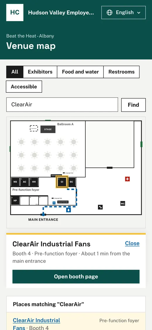
- The map shows the venue with the event's rooms named, the layouts in them, and the restrooms, water, elevator, stairs and first aid as symbols.
- Below the map, Places on the map lists every place by name, so the map works with a screen reader or without looking at the picture.
The map comes in the attendee's language, like the rest of the event's pages. Room names and layout labels are translated with the event's other text and can be reviewed under Languages and translation.
Find an exhibitor or a room
- Type a name in Find an exhibitor or room, for example the exhibitor's name, a booth number or "restrooms", and choose Find.
- When one place matches, it is chosen straight away; when several do, choose one from the list.
- The chosen place is outlined in yellow, and a dashed line shows the way from the main entrance with the walking time, for example "About 2 min from the main entrance".
- For an exhibitor with an approved booth page, choose Open booth page to read it.
- Choose Close to clear the choice.
Every place in the list is a link, so a place can be chosen with the keyboard as well.
Show one kind of place
Choose a filter above the map: All, Exhibitors, Food and water, Restrooms or Accessible. The places of the filter are outlined and listed; everything else is dimmed. With Accessible, the list shows accessible seating, the elevator and other step-free places, and every route avoids stairs and doors with steps. The place says Step-free route when there is one.
Print the directional signs
- Open the event and choose Floor plan in the left sidebar.
- Choose Directional signs.
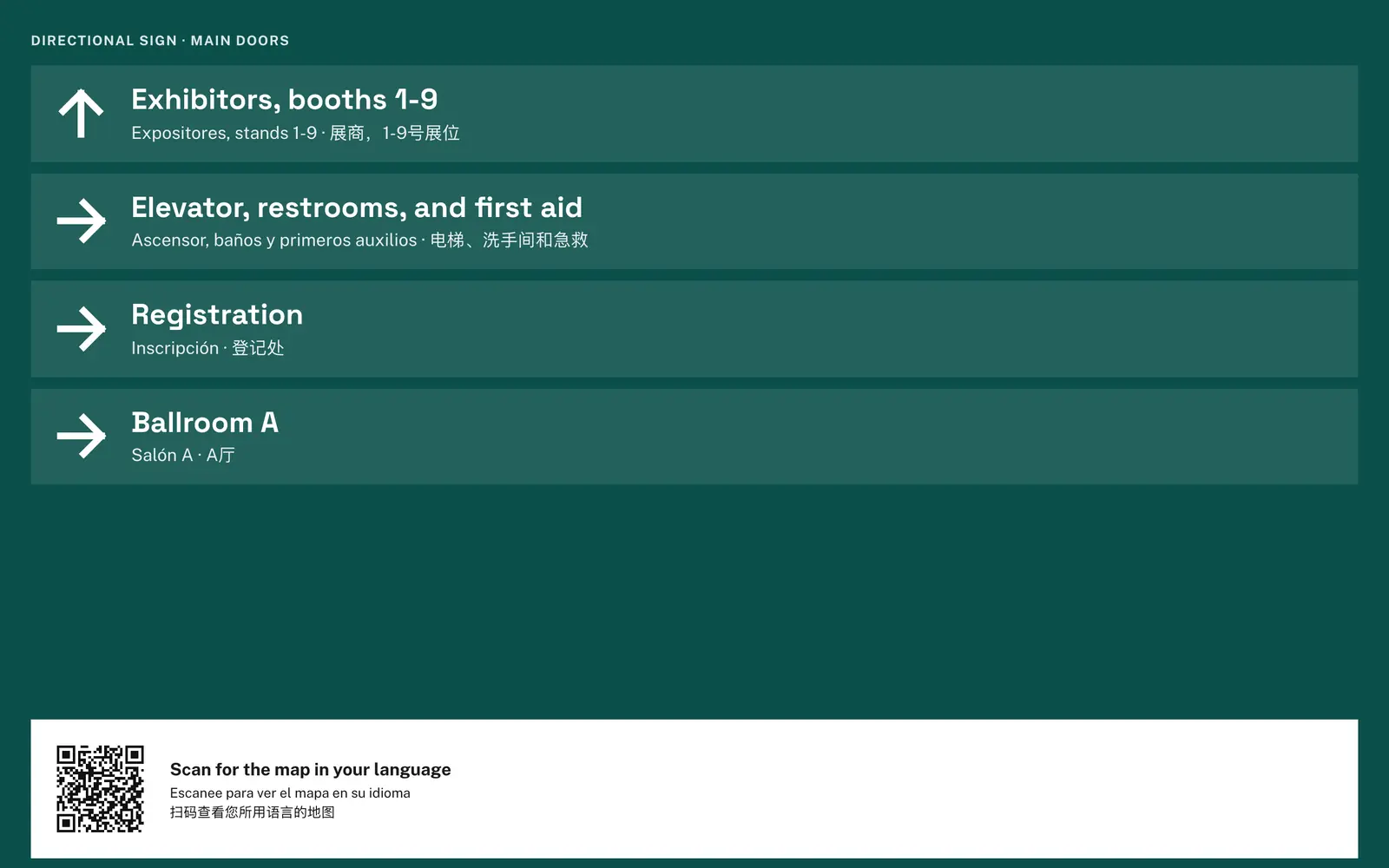
- Each entrance on the outside of the venue gets its own sign: arrows to registration, the event's rooms, the exhibitors with their booth numbers ("Exhibitors, booths 1-12") and the restrooms, elevator and first aid. Places in the same direction share an arrow, for example "Restrooms and elevator".
- Each arrow is labeled in the event's main language, with up to two of its other languages beneath.
- A QR code at the bottom opens the venue map, with "Scan for the map in your language".
- Choose Print; each sign fills its own US letter page in the organization's brand color.
The arrows point the way someone faces just inside the entrance, following the same walking routes as the map.
Print every setup sheet
- Open the event and choose Floor plan in the left sidebar.
- Choose Print setup sheets.
- The setup sheet of each layout the event uses follows the next, each on its own page.
- Choose Print all.
Who can use it
Anyone with the link sees the venue map of a published event; it needs no account and no ticket. Owners, admins and staff print the directional signs and the setup sheets.
Limits and edge cases
- The map never shows attendees, registrations or anything about who is coming.
- Exhibitors appear by name only when the event shows its exhibitors on the website; otherwise booths show their numbers. The Open booth page button appears only once the booth page is approved.
- The map is there for published and closed events, not for drafts or cancelled events.
- Service doors and power drops are left off the map, and service doors are never part of a route.
- Routes start from the venue's main doors on its outside walls; if none is marked on the outline, from every main door.
- When the plan has no way to a place (for example no step-free door into a room), the place says so and suggests asking at registration.
- Walking times assume 80 ft a minute and are rounded to the minute, never less than one.
- Labels of rooms, doors and venue features other than room names are not translated; the map and signs name features by kind ("Restrooms", "Elevator") in each language.
- Signs are labeled in at most three languages to stay readable from a distance; the QR code offers every language of the event.
Coming soon
- Routes from a door other than the main entrance, and between two places on the map.
- A sign for a door inside the venue, such as the doors of a ballroom.
From an AI assistant
get_directional_signswith{ eventId }: one sign per entrance, each with its door, the arrows (directionup,left,rightordown, and the label in each language) and the link of the venue map for its QR code.get_setup_sheetswith{ eventId }: the setup sheet of every layout the event uses, with counts and checks, as Print setup sheets shows them.
Find eventId with find_events.